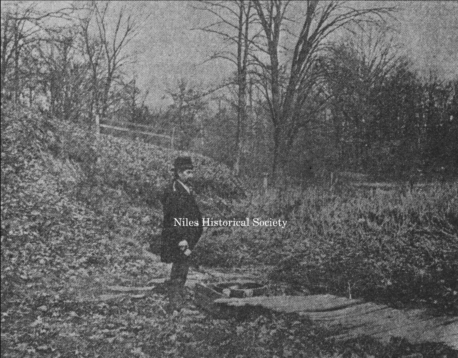
Salt Springs
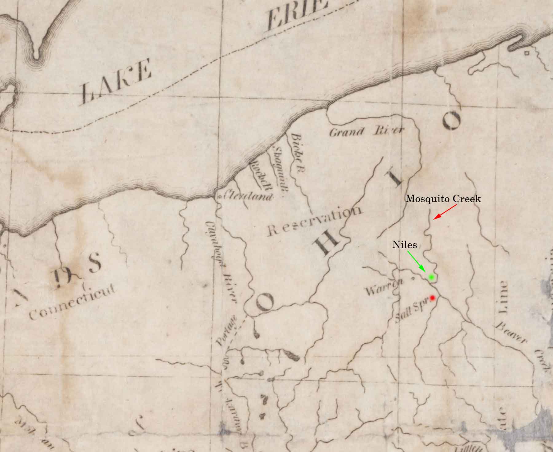
Early map of the Connecticut Western Reserve area marked with the location of the salt springs, Mosquito Creek and future site of Niles.
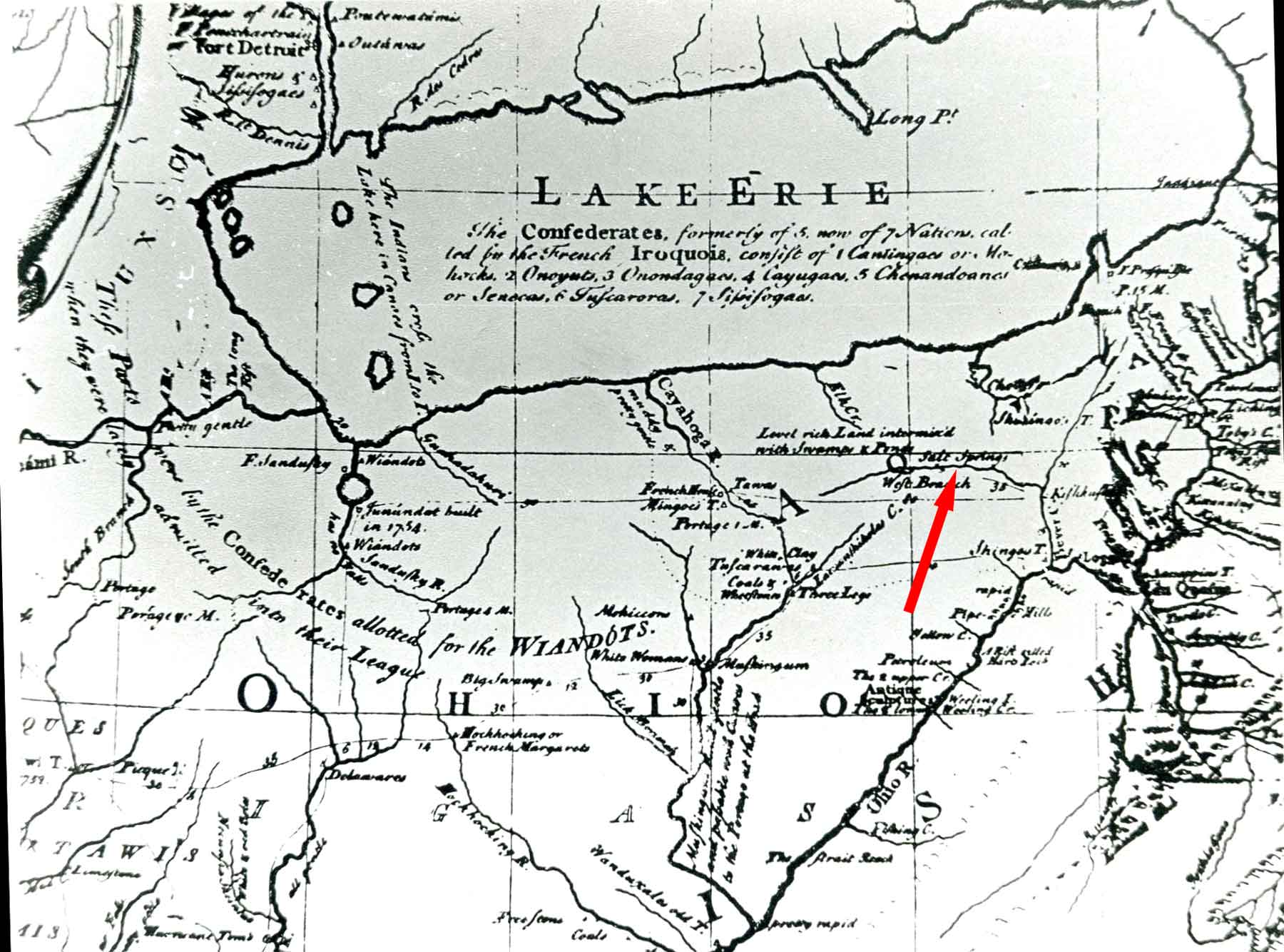
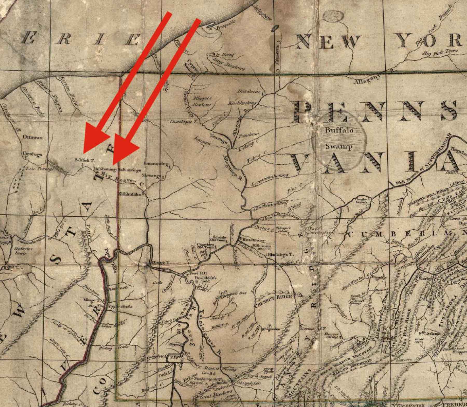
Lewis Evans Ohio Map of 1755 shows the Salt Springs existence was known in 1755.
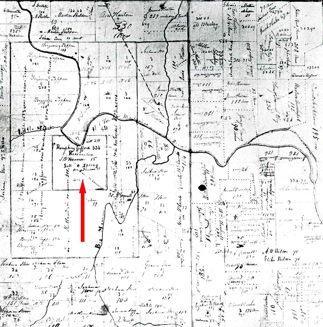
Weathersfield Township map illustrating the location of the Salt Springs area.
According to the 1787 map attributed to Thomas Jefferson, a salt spring is located somewhere within the city limits of Youngstown, Ohio.
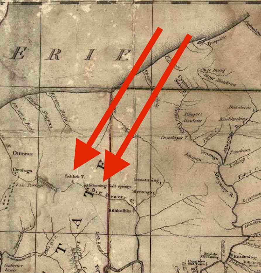
Please note that the upper reaches of the Beaver River were later renamed Mahoning River.
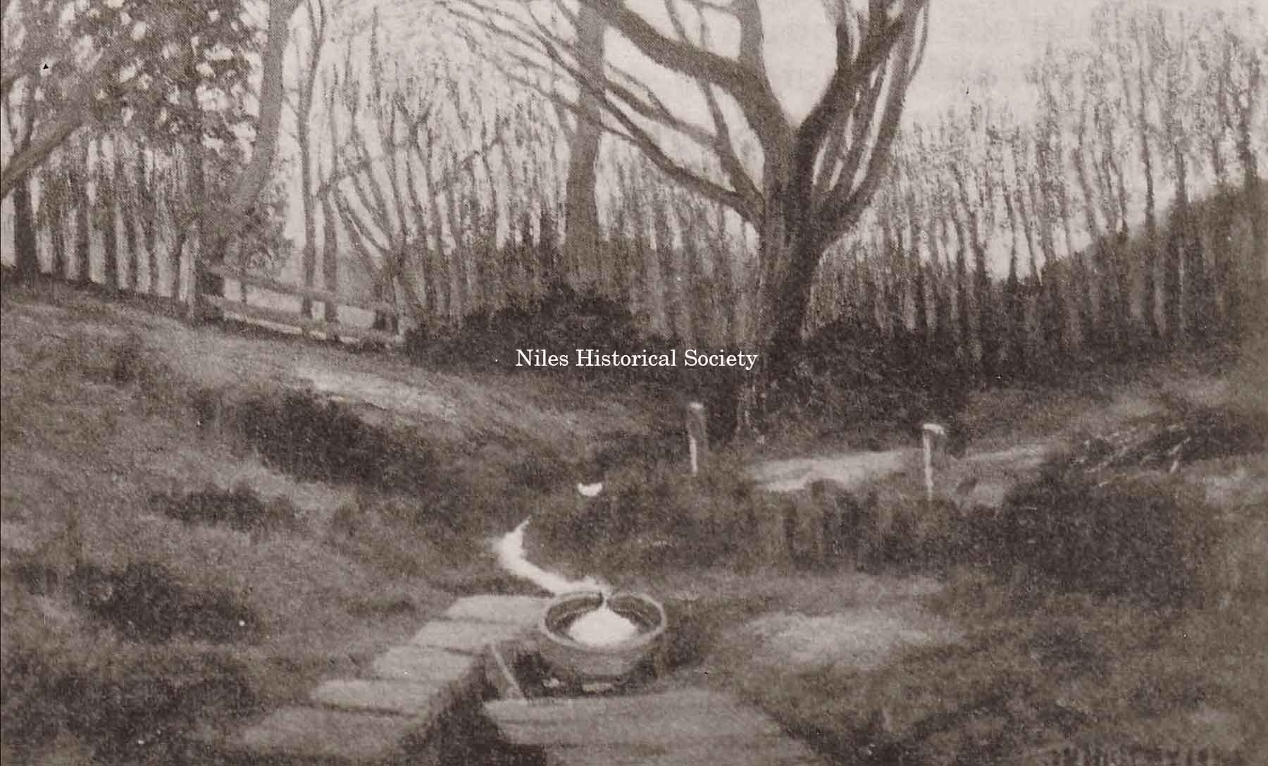
This illustration is from a painting by Joseph N. Higley, from a photograph taken by him about 1903, just before the Salt Springs were covered over by the B & O railroad fill.